Cultivating Knowledge
Botanic Garden and Nature Reserve - Caring For Our Hillside
Maps enable spatial information to be visualised and aid communication. Because KFBG occupies 143 ha of land, well-constructed maps are critical for coordinated forest management and restoration. For example, a Geographic Information System (GIS) is used to plot the location of trees planted on our roadsides so that data pertaining to their condition can be easily stored, retrieved and monitored. This is a vital part of on-site risk management and planning. The locations of individual trees are also mapped by our botanists during field surveys using GPS so we can revisit the same tree at a later date, for seed collection, for example. Similarly, the location of all trees seedlings planted out on our Forest Restoration Site are precisely plotted with a laser range-finder and mapped in Fieldmap software (https://www.fieldmap.cz/) to allow us to keep track of the growing trees’ performance in the long run.
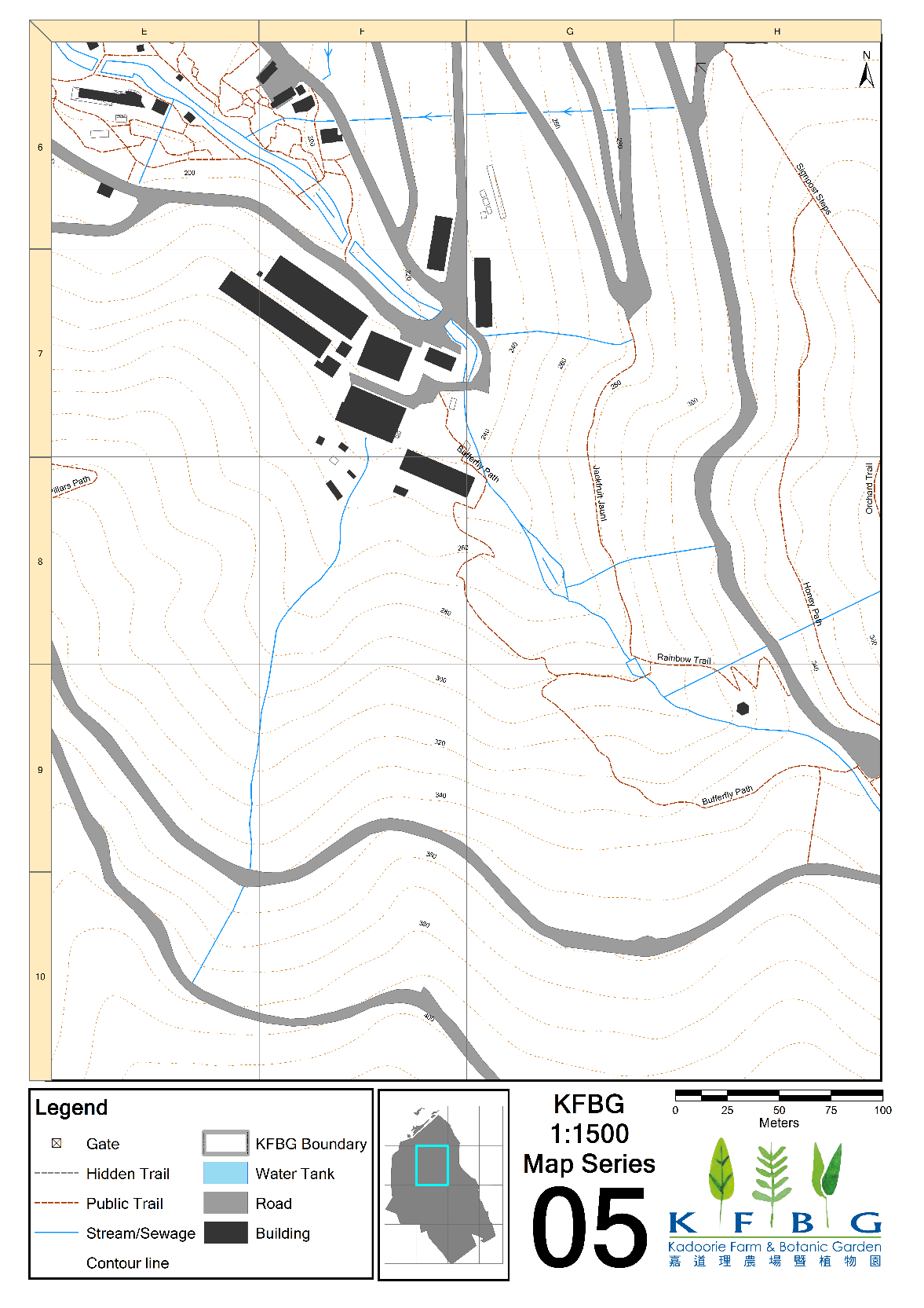
In addition to mapping the physical location of individual features such as trees, we use GIS to divide the site into a series of 100 m2 grid cells to aid spatial planning, emergency management and communication. A map of KFBG at a 1:5000 scale has been subdivided into 13 smaller zones, each at 1:1500 scale. Each 1:1500 map contains twenty 100 m2 grids with vertical and horizontal indexes. These indexes allow accurate communication of specific locations when there is an emergency, such as an accident, an outbreak of hill fire or a sighting of poachers. On top of that, these maps facilitate systematic implementation of plant and animal censuses and routine patrols.
Figure 1: Record location of road-side trees with GIS, and categorized according to priority.
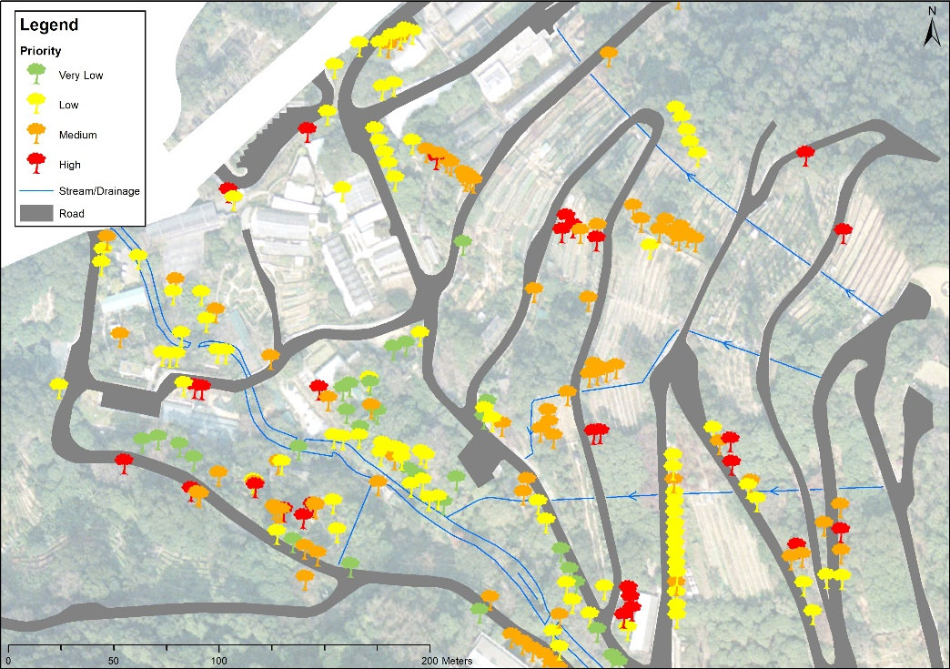
Figure 2: Using both GIS and Field-Map to record the location of trees and seedlings at the restoration site, showing the map of Machilus chekiangensis as an example.
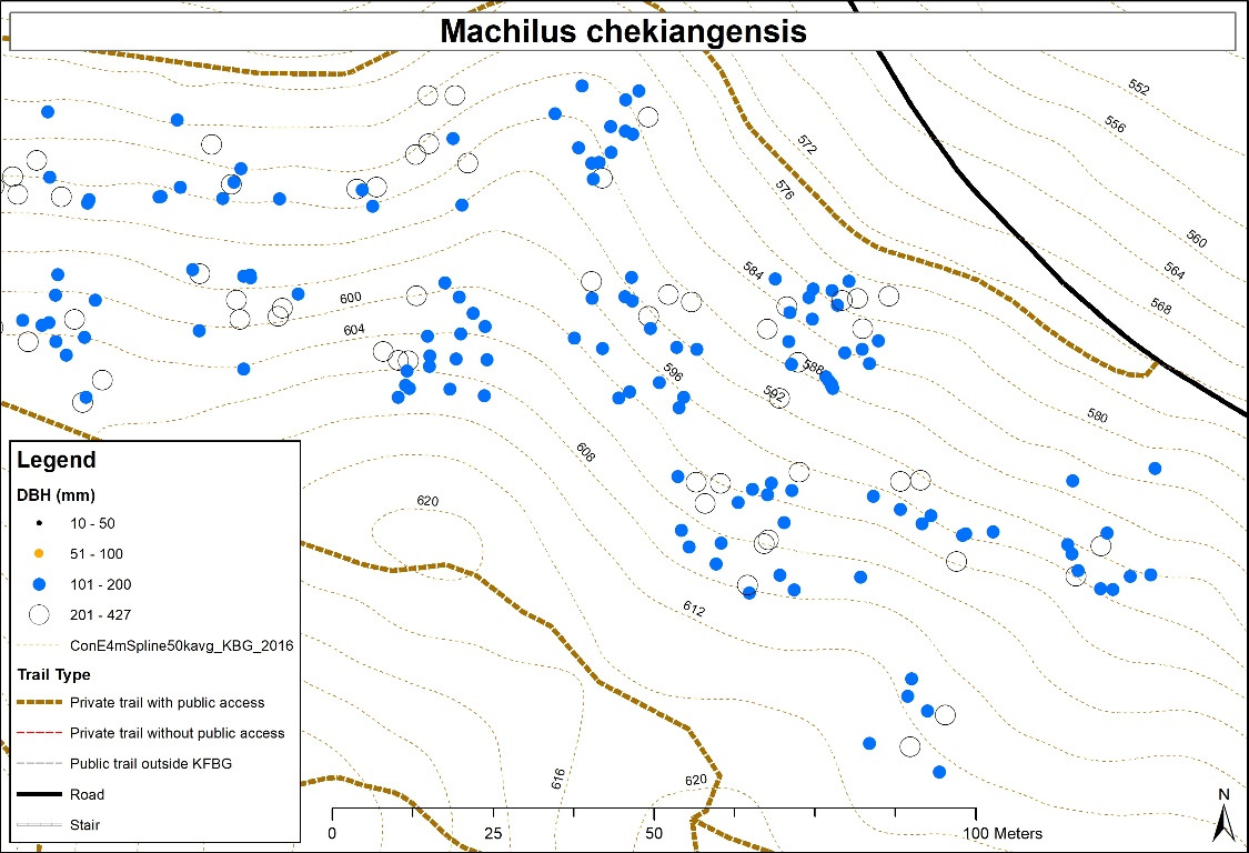
Figure 3: A sample of 1 to 1500 map at KFBG, each grid equals to 100m2.