Cultivating Knowledge
Botanic Garden and Nature Reserve - Caring For Our Hillside
“What should we plant at this location?”
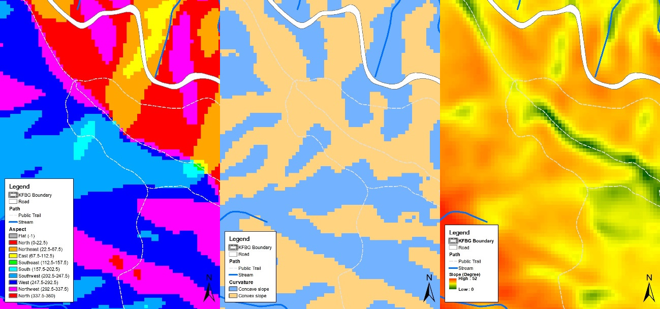
To better implement forest restoration at KFBG, we gather spatial information using a Geographic Information System (GIS) to keep a record of the locations of all trees planted on our site. GIS supports restoration planning by analysing our environments in digital form. Topographic factors such as slope, aspect and convexity can be computed from the digital elevation model (DEM). Climatological factors such as incoming solar radiation, wind speed, temperature and precipitation can also be interpolated and modelled. With GIS, we can combine various factors and produce a zoning map of each habitat. The data can also be used to model species’ distributions and to extrapolate habitat suitability to other locations or under projected future climates.
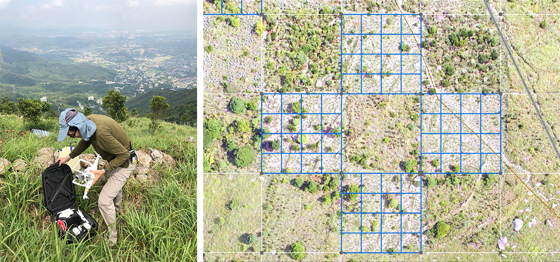
At KFBG, we learn and apply our knowledge of forest ecology and restoration through field experiments at the Forest Restoration Site. To better plan these experiments, we set up a coordinate system for systematic research and management. The system is based on a 20 ⨯ 20 m grid that meets the standards of the global monitoring network for forest research plots (https://forestgeo.si.edu/). Each grid cell is subdivided into sixteen 5 ⨯ 5 m grid cells for our tree-planting experiments. The location and condition of each tree seedling within these smaller grid cells are measured annually. Data accumulated over multiple years can then be used to analyse the performance of different tree species in terms of particular spatial variables.